
|
| |
|
|
|
|
After the acquisition of Walton’s Mills by the Crown in 1785, the site extended over a mile and a quarter from north to south. The Grand Magazine was built at the extreme northern end in about 1800. New process buildings were situated at extended intervals over the distance between there and Walton’s original works. The Millhead Stream and the River Lea formed the eastern and western boundaries at that time, so those waterways were the basis of the canal system which would provide safer and probably faster transport links. It should however, be said that speed was not as much a prime factor inside the Mills as on the swiftly developing canal system in the outside world. Safety is compromised when speed is of the essence!
As no engineering or contracting reports of the day have survived, the only way to determine the sequence of waterway building within the Mills is to examine sequentially the collection of maps held in the Gunpowder Mills’ archive. It should theoretically then be possible to assign a “latest” building date by noting the new canals as they appear on maps. The site surveys were taken at irregular intervals, so some canals could have been in existence for quite a long time before they first appear on a map.
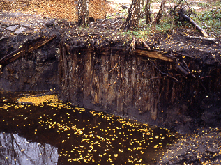
When canals were first built in England in the Manchester area in 1759, the use of puddling clay to line and waterproof the channel was almost universal, except where the canals were dug through non-permeable strata. A cross-section of a typical canal showed a flat bottom which sloped up at either side to the banks. When the canals in the Mills were dredged during the decontamination process in the early 1990’s, it was revealed that the early channels, at least, were built with timber reinforced vertical sides. This meant that narrower channels could be used which were usable up to the edges, built just wide enough to permit two boats to pass each other.
Vertical edge of the early canal that was built between the Millhead Stream and the Press House. Richard Thomas
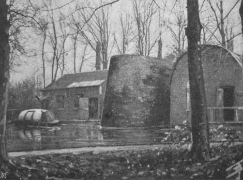
There were only two canals initially and both were in place by 1806. They gave access from the Millhead Stream, and thus the mills lining that waterway, to corning mills both built close to the River Lea. The Lea was six feet lower than the Millhead, providing the head necessary to drive the waterwheels when the corning mills were later converted to press houses utilising hydraulic pressure created from the rotary action of the wheels.
The Press House with a gunpowder boat. RGPF, Waltham Abbey
Thus, some of the canals within the site were dual purpose; using the water flow to drive the machinery and the surface to move the purpose built boats which carried the gunpowder ingredients and compounds as they proceeded along the manufacturing flow line
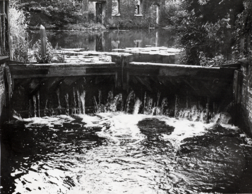
The third channel, built in 1806, was the Powdermill Stream which provided a connection between the Millhead Stream and the relatively new Lee Navigation. This had been built in 1770 and gave a wide modern pound-locked channel directly to the Thames, without the shallows, bends, mills, weirs and flashlocks of the old Barge River. The Navigation was 2 foot 6 inches lower than the Millhead so it was necessary to build Edmonsey Lock to overcome the difference.
Edmonsey Lock
RGPF, Waltham Abbey
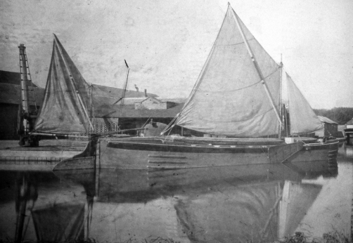
Lady of the Lea RGPF, Waltham Abbey
There was now a direct waterway connection between the Grand Magazine holding the finished gunpowder and the magazines at Purfleet, without passing through the Mills. By 1806 there were already at least five barges carrying gunpowder between Waltham and Purfleet. One of the gunpowder sailing barges, Lady of the Lea built in 1933, still survives. Another sailing barge hull survives sunken in the canal that parallels the incorporating mills on Queen Mead.
Lower Island was established, with its supporting waterways, to the south of Highbridge Street soon after 1806. By 1827, Queens Mead had drainage ditches and tail streams around the edges and another ditch bisecting it. There were a number of small waterways serving the lower part of the Mills just north of Highbridge Street. A survey in 1814 included the information that there were “five barges, nine powder boats, two ballast barges and six punts”
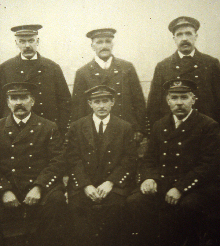
Barge captains c 1905 RGPF Waltham Abbey
The forty six year unmapped period up to 1866 saw the development of the steam powered incorporating mills along Queens Mead together with the first “carriage only” channels. These waterways were designed not to provide flowing water power to millwheels but solely to transport materials to and from the incorporating mills, although the northern part of the Queens Mead channel did act as a tail stream for the blank cutting house situated on a side cut from one of the original pre-1806 canals. Further north, part of the other original canal was abandoned in favour of a shorter route, although the remaining section provided the link to a new canal serving the gunpowder granulating house by Newton’s Pool.
The map above shows the three dates on which surveys were taken, 1806, 1820 and 1866. The application of a date to a waterway indicates only that it was in existence by that date; it is not the date the waterway was built.
In order to simplify the map, no tail streams or drainage channels are shown. Waterways within the Mills which later became extinct are shown in a lighter colour.
|
This site was last updated 05-Dec-2011
 By
1806, there were mills on the western side of Hoppit Island along the
line of the Horsemill Stream. Flowing originally from the Hooks Marsh
Ditch (itself fed by the old River Lea), it wandered down the western
side of the Millhead Stream to rejoin the river below Highbridge
Street in Waltham Abbey. Part of the Hooks Marsh Ditch, to the north, had been used for
the route of the Powdermill Cut.
By
1806, there were mills on the western side of Hoppit Island along the
line of the Horsemill Stream. Flowing originally from the Hooks Marsh
Ditch (itself fed by the old River Lea), it wandered down the western
side of the Millhead Stream to rejoin the river below Highbridge
Street in Waltham Abbey. Part of the Hooks Marsh Ditch, to the north, had been used for
the route of the Powdermill Cut. 